Англійська

Англійська » Guidebooks » MAPS

Показано 1-4 з 4 записів.
Ціна (грн) Кількість Разом (грн)
Путівник

"Castles Map of Scotland"

ISBN: 9780008183714
Видавництво: Collins

Explore Scotland's ancient monuments with this pictorial map featuring over 700 castles and fortified houses. Includes an easy-to-use index listing visitor information and an attractive selection of photographs.The map includes:

  • Over 700 castles and fortications
  • Index comprises map references, the age and type of each castle, public access details, Historic Scotland and National Trust for Scotland ownership, notable grounds and gardens, telephone numbers and websites
  • Highlights Scotland's finest castles, castellated mansions and also the best castles for children
  • Attractive photographs of a selection of castles, together with a brief account of their history
  • A brief history of Scottish castles and information on architectural types and periods of construction
  • Internet links and suggested reading for further information
180.00

*Роздріб. На гуртові замовлення – знижки. Для детального розрахунку змоделюйте замовлення.

-
Путівник

"Collins Discovering London. The Illustrated Map"

ISBN: 9780008214166
Видавництво: Collins

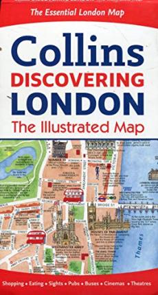
This hand-watercolored map contains individual paintings of all the main sites and landmarks, shop-by-shop street maps, theatres and cinemas, comprehensive travel information and index. At a scale of 1:8,250 (7.5 inches to 1 mile). Coverage extends from Regent’s Park in the north to Battersea in the south, and from Kensington in the west to Tower Bridge in the east. Features hop-by-shop street maps for Oxford Street, Bond Street, Covent Garden, Portobello Road, King’s Road, Brompton Cross, Exmouth Market, Beauchamp Place, St. Christopher’s Place and South Molton Street, Knightsbridge, Jermyn Street and Kensington.

180.00

*Роздріб. На гуртові замовлення – знижки. Для детального розрахунку змоделюйте замовлення.

-
Путівник

"Collins London Handy Street Map"

ISBN: 9780008136642
Видавництво: Collins

Clear and easy-to-read map of central London and surrounding area. Contains detailed mapping, presented in a handy compact format. This attractive map, ideal for bothtourists and residents, and fully updated, has an extensive area of coverage and displays a wealth of detail.This map includes:Fully classified roads; Colour-coded buildings; Postal districts and boundaries clearly depicted; Full indexes to street names, place names and places of interest; Fully updated London underground map conveniently located on the back cover. Area of coverage: Extends from Hampstead in the north to Clapham in the south and from Hammersmith in the west to Greenwich in the east.

108.00

*Роздріб. На гуртові замовлення – знижки. Для детального розрахунку змоделюйте замовлення.

-
Путівник

"Collins London Pocket Map"

ISBN: 9780008214173
Видавництво: Collins

Handy little full colour Collins map of central London with a high level of detail. Clear mapping of central London from Regent’s Park in the north to Kennington in the south, and Kensington Gardens in the westto Tower Bridge in the east at a scale of 1:12,500 (5 inches to 1 mile). Maps of West End shopping and theatres are also included. Clear,detailed, full colour Collins mapping is presented in a handy format ideal for the pocket or handbag. It is excellent value and covers the most visited area of central London. It is an essential buy for tourists and residents alike.

72.00

*Роздріб. На гуртові замовлення – знижки. Для детального розрахунку змоделюйте замовлення.

-